In the summer of Covid-19 we snapped up a campsite at Kokanee Creek provincial campground, north of Nelson on the West arm of Kootenay Lake. We planned to use this as a base camp and do a few backpack trips and day hikes, plus visit Nelson and it’s great bakeries and cafes for the first time in 15 years. We made the 9+ hour drive to Nelson on Saturday (via Princeton, Osyoos, and Grand Forks).
Iron Horse (virtual/literal) Half Marathon
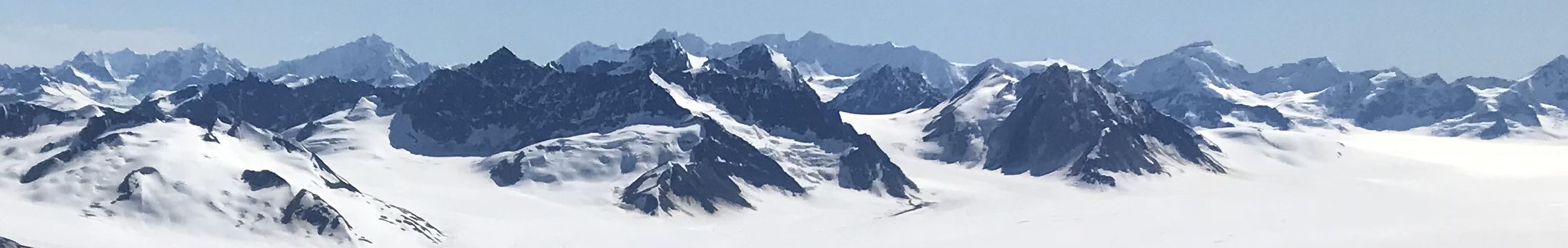
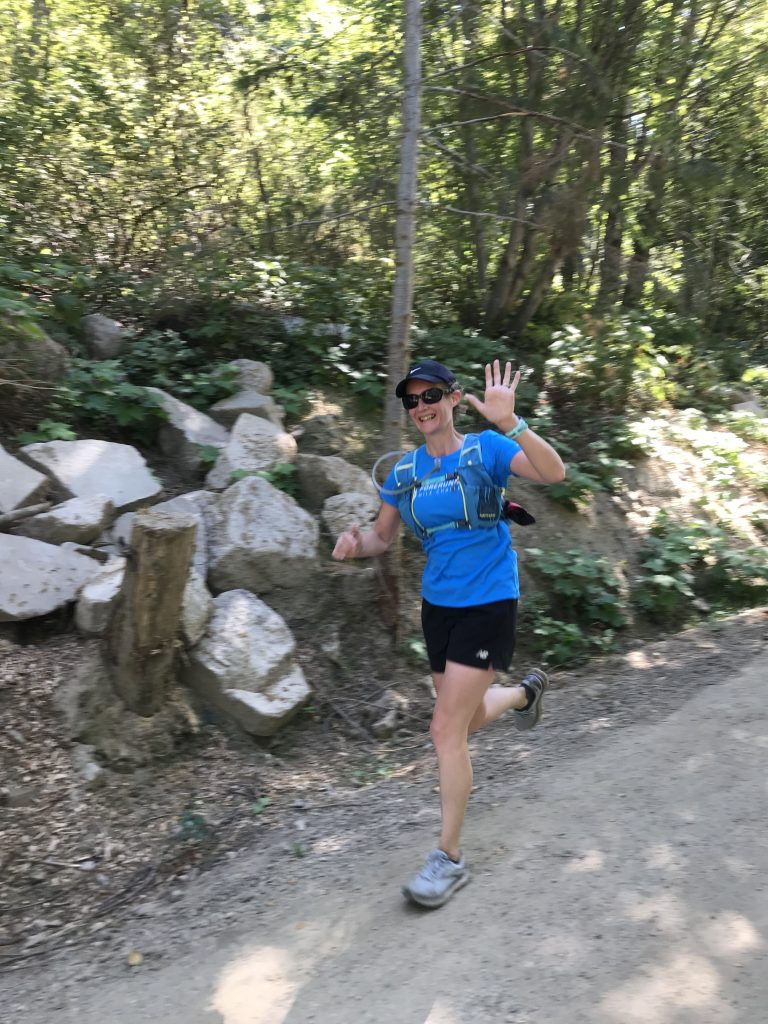
On Sunday we were supposed to be in Washington State running the Iron Horse Half Marathon. We decided to run the virtual race on the Great Northern Rail Trail from Mountain Station in Nelson. The route had substantially more elevation gain than Iron horse, but after climbing to halfway, the second half was fast. We rewarded ourselves with Oso Negro coffee and ice cream.
Kokanee Glacier Provincial Park Backpacking – Kaslo Lake, Sapphire Lakes, Glory Basin, Slocan Chief Hut, and Kokanee Glacier Toe
The access to the trailhead for this hike is across the highway from our base camp and 16 km up a gravel road to Gibson Lake. At the parking lot, there’s a supply of chicken wire so you can protect you car from voracious porcupines that come out at night to eat your tires and brake hoses!
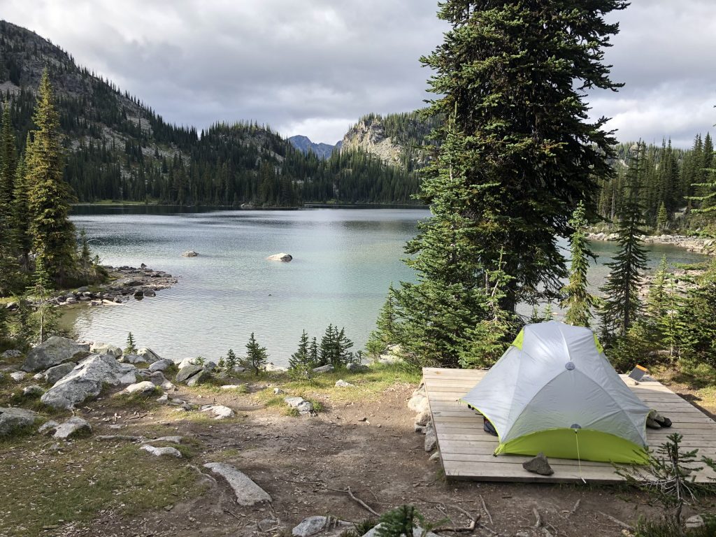
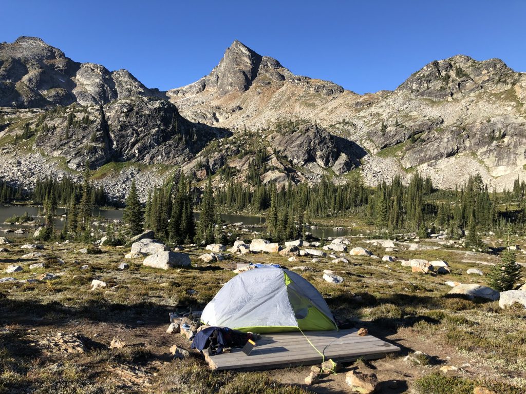
The hike up to Kokanee Lake is super easy – great trail building by BC Parks. From Kokanee Lake, we breezed along the western shore of the lake through the boulder field – eased due to solid trail building efforts. We crossed a nice meadow at the end of the lake and reached Kokanee Pass. It’s easy going from here and we passed Keen and Garland lakes before reaching Kaslo Lake Campground. It’s a great campsite with 10 pads and a new cooking shelter (closed due to Covid 19). With good if chilly and windy weather we did not need the shelter and had the lakeshore camping to ourselves.
After a coffee and some lunch, we hiked up to the historic Slocan Chief Hut, which was built in 1896 as part of the mining boom in the area. It’s now open to day visitors as a tiny backcountry museum and has lots of great old photos, artifacts, and stories inside. From here we hiked up the meadow and scree slopes to catch a glimpse of the toe of the Kokanee Glacier (another once mighty but receding glacier).
It rained overnight and was blustery and a bit cloudy in the morning. But good hiking weather for us to head around Kaslo Lake, past the BC Parks cabin, and up Griffin Creek to Lemon Pass and Sapphire Lakes. This is a great day hike and we extended it slightly based on our old “Gotta Hike BC” book that recommends going up into Glory Basin above upper Sapphire Lake. With ominous clouds we didn’t go all the way up the basin, but reached a great viewpoint.
We returned to the campsite for lunch and a coffee, before breaking camp and dropping back to the car. Fortunately, our car survived the hordes of porcupines. Great hike, a hidden gem!
Check out our Google Photos album of the Kaslo Lake Hike.
Rest Day in Kokanee Creek campground
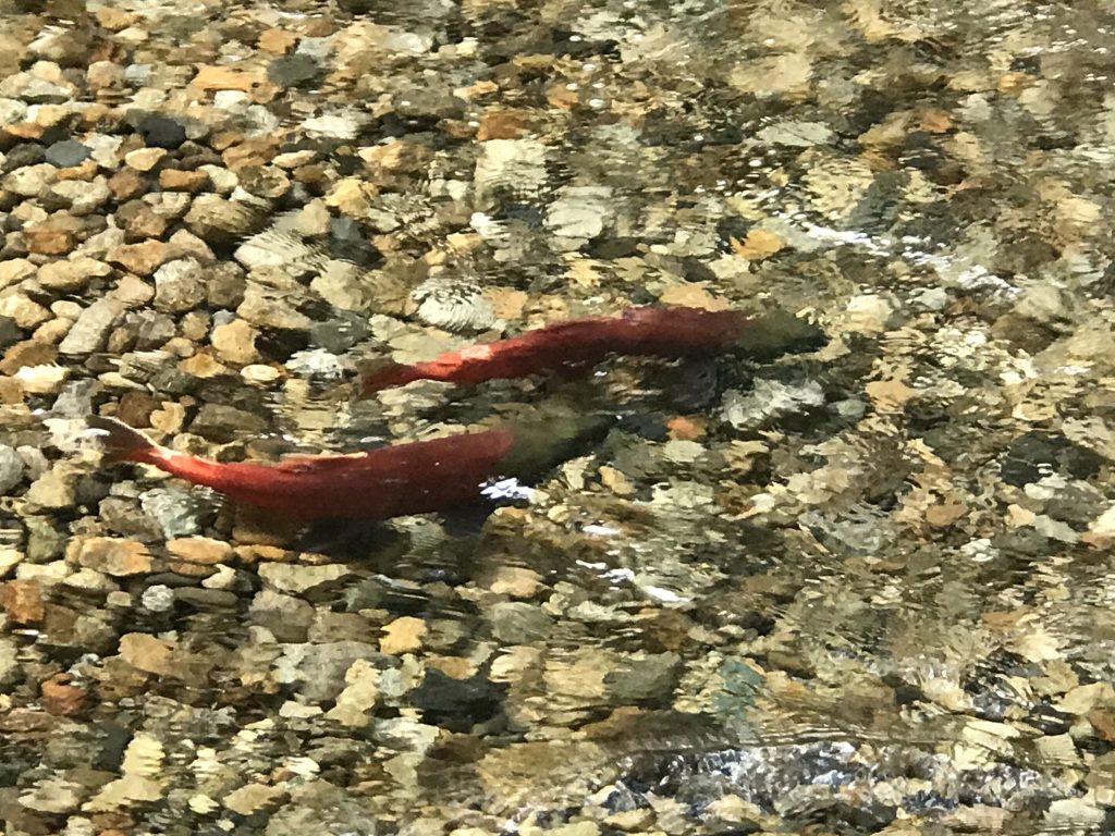
We had a day off to decide on plans for the next half of the trip, and also walked the short distance to the visitor centre in the park to see the Kokanee salmon run. The Kokanee salmon are Sockeye that were landlocked at the end of the last ice age 10,000 years ago. Now they simply move from the small streams down into Kootenay Lake to mature, rather than going out to sea. After 3 years they return to spawn. As Kokanee Creek was dredged and straightened in the 1960s, the salmon habitat was destroyed, and an artificial spawning channel was constructed, giving easy viewing of the returning redfish.
Valhalla Provincial Park backpacking: Gwillam Lakes and Lucifer Pass
Our second backpacking overnight was to Valhalla Provincial Park, west of the Slocan Valley. We left Kokanee Creek early knowing that the Perry Ridge wildfire meant that access from the south end of the Little Slocan FSR was closed. We drive to Slocan City (a small village) and then back south to access the Hoder Creek FSR. We’d read and been told that the last 2 km of the FSR is rough and brushy. At the parking area before this section, a guy with a Subaru Outback said it was gnarly and he’d turned back. So we decided to hike this section and not risk it. In fact, the road was fine for our Forester and we regretted not giving it a shot. We also regretted not checked wiring our car against porcupines, even though BC Parks does not mention it. Some cars were wrapped at the real trailhead!
The trail itself is an easy steady hike to Drinnon Lake and then up to Drinnon Pass. The trail is much less built than Kaslo Lake, which makes it more enjoyable – the edges less sanded off this wilderness. We dropped into the valley from Drinnon Pass and then climbed up to the wonderful alpine bowl that is Gwillam Lakes.
The campsite reminded us of Elfin Lakes in the Lower Mainland. Wooden platforms in a heather meadow with a gorgeous view. More space than Elfin. We were the first to arrive that day and picked a great spot overlooking the lakes with Lucifer Peak looming.
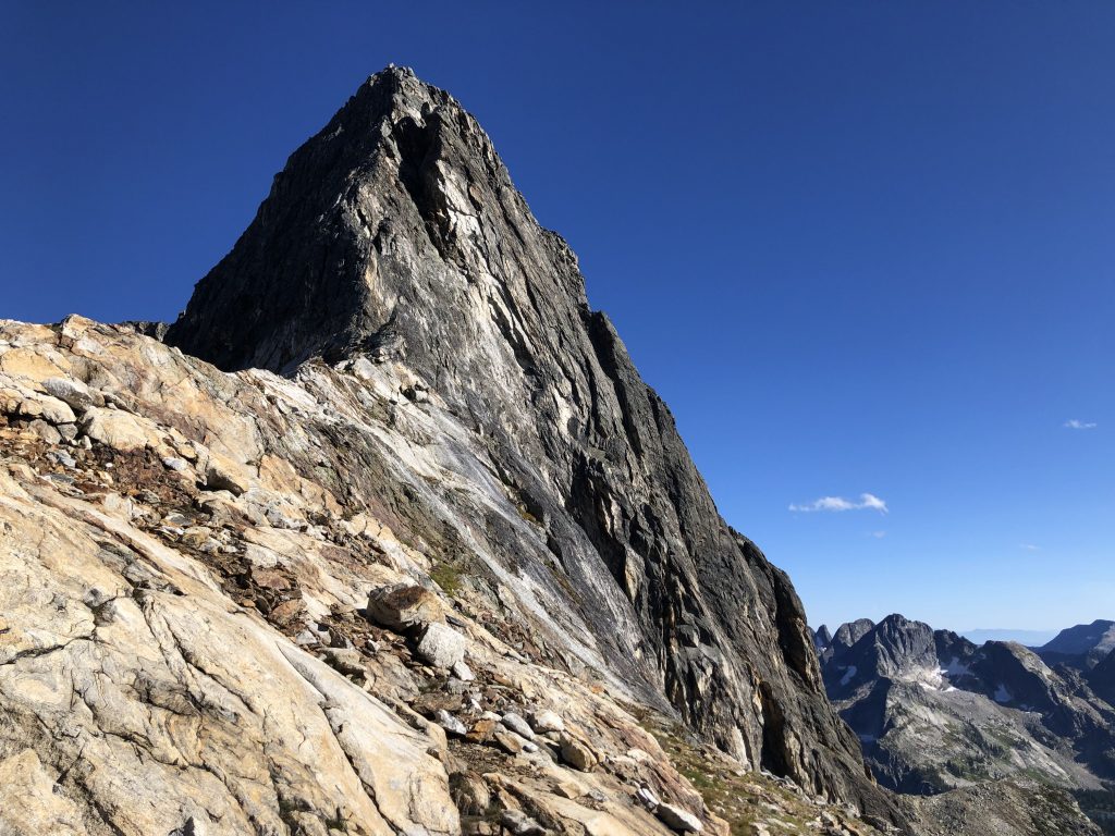
Our bonus hike (since Gwillam Lakes alone would be too simple) was to scramble up to Lucifer Pass (2585 m), the notch time the east of Lucifer. This was an easy scramble up a grassy scree/boulder field to upper Gwillam Lake and then a more arduous scramble up to the pass, including a few snow patches. Well worth the effort since the views of Lucifer itself, the Valhalla mountains north through the pass were fantastic. We dropped down to the campsite for a classic spicy noodle and veggie dinner by the lake. It was a warm September evening. Later we watched the sun sink and the bright moon rise. Lots of stars and fast moving satellites.
The following morning we decided to make an early start. Up before the sun had risen above the mountains. We had a good breakfast just being ready to leave before the mosquitos woke up – it was very buggy with no breeze.
On the drive down the Slocan Valley, we stopped at the excellent Mama Sita’s Café (great burgers and salads!) and Gaia Tree Wholefoods. We stopped in Nelson to restock essential provisions (Kootenay Bakery Cooperative and Firelight Brewing).
Check out our Google Photos album of the Gwillam Lakes hike.
Macbeth Icefield
On our second last day we chose one of the day hikes recommended in our book. The original trailhead isn’t accessible now, but it’s just a km or so up the old overgrown road to the original trailhead.
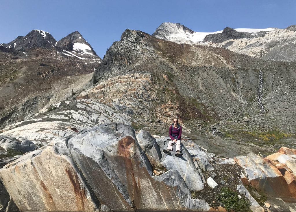
The path has a reputation for being very steep and somewhat overgrown, but it has been very recently cleared and although steep, was pretty easy going. There are two steeper sections with a flat valley floor in between. The valley itself is boggy and filled with Alder, but you follow a blue glacial stream, and can see where you’re aiming for. Once you’ve conquered the second, steeper section, you pop out onto the top of headwall at the back of the valley. Then, it’s just a question of following cairns and then walking up the spine of a long lateral moraine, all the while looking at the massive MacBeth Icefield on your right. At the top of the moraine, you drop down a little before climbing up onto a large outcrop of granite. From there are multiple ways to drop down to the small lake at the toe of the glacier. You can pick your way around the water’s edge and get right under the ice. It’s pretty amazing to get underneath the glacier like that!
Check out our Google Photos album of the MacBeth Icefield hike.
Mount Brenan
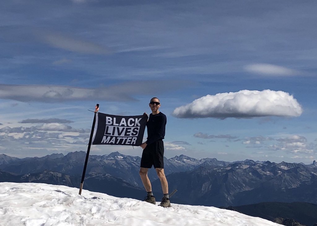
On the final day we briefly considered sitting around camp drinking beer but pushed ourselves to climb Mount Brennan instead. Since our book was written, the location of the trailhead has been changed due to multiple mining claims on the land that mean access has been restricted. The directions online sound convoluted but we found our way pretty easily. The new trailhead and trail eventually link with original, and now very overgrown, parking lot. The first part of the hike takes you up a steep slope and over the headwall into the basin that contains Lyle Lakes. We didn’t think the Lakes were especially lovely although they are an interesting opaque blue due to the silt, but carried on to tackle Brennan. The hike is a really long slog through what seems like endless fields of boulders and rubble. There is a lot of evidence of small-scale mining on the slopes immediately above the lakes. There are cairns to follow but it can be hard to pick them out in the jumble of rocks. Gill’s concern, being a pretty incompetent scrambler, was being able to pick out the route back down, as there are limited options down the wall at the back of the lakes. It was a very long hike to get to the top of Brennan at 2902m. The views were amazing up there, you can see for miles in all directions on the clear day. we were lucky that the wildfire smoke wasn’t impeding the visibility. Someone had even planted a Black Lives Matter flag on the summit!
We didn’t tarry too long but started the haul back down. This was made easier as we did slide down some of the snow slopes. Some are very steep so we stuck to the edges and took it easy and being very careful. It saved a lot of time and effort. Finding the route back was easier than expected and we got back to the car in good time. It’s amazing to be able to summit a major peak in this area and we really recommend this hike!
Check out our Google Photos album of the Mount Brenan hike.