 This weekend we went to Bandung to climb Gunung Cikuray with Merrin, Pete and Dan who we met on the Java Lava trip to Gunung Lawu. Bandung is the largest city in West Java and is about 3.5 hours drive to the east of Bogor. It is surrounded by mountains and has a reputation for being one of the more cosmopolitan and liberal cities in Java. It is also famous for having terrible traffic on the weekends as everyone from Jakarta goes there for outlet shopping.
Unfortunately I had a workshop in Jakarta on Saturday morning (How to write a scientific paper) so by the time we got to Bandung it was already 6 pm; just time to drop our bags at Merrin and Pete’s place and head into town for some dinner. This was out first trip to Bandung and we were pleasantly surprised to find a green city with lots of great restaurants (very important for me!). We headed down to Jeans Street where, you guessed it, there are endless shops selling jeans. To make things a little different, the shops are decorated with giant figures such as Rambo and Superman mounted above the shopfronts.
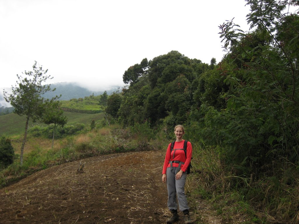
We didn’t stay out too late as it was alarm clocks at 3.40 am for a 4 am pick up to drive out to Cilawu near Garut to the trailhead. The drive took about 3 hours, with 8 of us crammed into Merrin’s small work car (Toyota Avanza). The last 6 km of the drive up a rather rought road climbing up through a lovely tea plantation to the TV broadcasting station above it. The road was so rough in places so we all had to get out at the steep parts and (at one point) push! The weather was cool and misty, but we set out hoping we’d be above the clouds as we got higher. The trail was good, similar to Gunung Salak, with lots of roots to climb up and over. Further up the forest was festooned with lichen and full of lovely plants. We’d heard wildly varying reports of the time needed for the hike, ranging from 7 hours round trip to 15 hours, so we were glad to reach the summit in 2.75 hours (Dan, Pete and Merrin) and 3.25 hours (me, and Andy hanging about to keep me company). We just made it before the clouds came it and got some views of Gunung Papandayan and the plain below.
The route back was the same as the way up and we were happy be to down in 2.25 hours. We walked down through the tea plantation and hung about for a while waiting for the driver to come back. We didn’t get him to come right to the trailhead this time, thinking that we’d burned enough rubber off the tires on the way up. 3 hours later we were back in Bandung and getting cleaned up. We went out for a great Italian meal and some celebratory beers at the badly named but well situated Fashion Pasta, with views out over the city lights below.
We had a great weekend and will definately be back in Bandung another time; it is a great city, with plenty more good hiking in the surrounding area. Check out our Google Photos!
Do you have a GPS tracklog for your hike to the summit of Gn Cikurai?
Yes, you can access them here as KML files:
Tracks
Waypoints”
Tracks may not be accurate in the forest because of the canopy, but they should help with finding the trail. You might also want to check out gunungbagging.com for information.