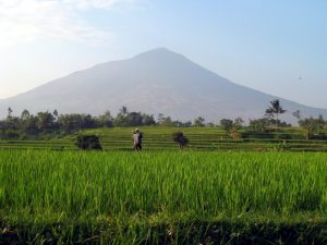
 Before the start of the long wet season and some busy work schedules, we decided to squeeze in bagging one last local West Java volcano. Mount (Gunung) Papandayan is not a hard one to get to or climb because you pretty much drive into the crater, but somehow we failed to make it to the actual summit, although not for lack of trying.
We left Bogor on Saturday morning to do a quick errand in Jakarta, before heading onto the toll road for Bandung – yes I was brave enough to drive at least part of the way to Papandayan. In Bandung we met up with our Java Lava friends Merrin, Pete, and Dan (who had taken the morning train from Jakarta). We left my office car safely parked and had Merrin’s office driver to take us Cipanas, where we spent the night close to Papandayan so we could make an early start. In Indonesian, “Ci” in a place name means “water” and “panas” is the word for “hot” – so you guessed it, Cipanas is a small town where there are famous hot springs. Unfortunately, it’s also popular for weekends away from Bandung, and so we ended up in a fairly crappy place that was too close to the noisy town centre; however, even this place had hot spring water piped in to the bathroom, so at least the mandi (bathing) was warm.
The next morning we set off early and had good views of Gunung Guntur on the way to find the road into Papandayan. At the car park in the crater we were inundated with offers for a guide, but we decided we could make the summit on our own. How hard could it be, since this is not even a “proper hike”, right? The problem was that we thought it was going to be too easy, and had not consulted the internet or maps to figure out the summit and we didn’t know which of the separate peaks surrounding the crater was the highest point. We set off for what we thought was the best chance. It was really amazing in the crater. It’s like a tour through the outskirts of hell, with lots steaming hot streams, small and large sulphur vents, a weird coloured pond, dead trees, and (best of all) a large pool of fiercely bubbling mud. The paths wind their way through all this and things are not fenced off signed at all – hold onto your small children or they could disappear. Check out the photos and the video of the mud. Simply crazy – we love it.
After some wandering and aborted scrambling, we were reliably informed by several people that what did not appear to be the highest point was in fact the summit; so we set off hiking like crazy to make up for lost time. We jog-walked for about an hour and came out onto a really interesting plateau area with several thicketed potential summit areas all around. There are no signs up there and it is easy to get disoriented. After a few attempts to climbs through some thickets, we simply had to give up and head back. My GPS came it quite handy at this stage because the path back is not clear.
Sometimes the supposedly easy mountains are not the easy one to climb. Our post-hike checks show that I wandered pretty close to the summit, but not close enough. Most people don’t try to hike to the highest point, and the papandayan summit is not actually marked. So, this is a place we will have to come back to – and it is so interesting that we don’t mind at all.
Check out our Google Photos!
