
Gill crossing Lizzie Creek the safe way
Third time lucky! We first tried to hike up to the Stein Wilderness from Lillooet Lake about four years ago, but the road around Lillooet Lake was washed out in an intense overnight storm just before the Labour Day weekend. Earlier this year our BC Day plans were scuppered by record high temperatures plus haze and smoke from the massive BC wildfires. Finally everything aligned and we drove up to the logging road towards the trailhead at Lizzie Creek. We overshot the starting location at first since the active logging road continues up into an adjacent catchment. In fact there are TWO trail heads for the hike, which we only realized when we exited by the other one. We recommend starting at the slightly higher trailhead.
Day 1 – Lillooet Lake trailhead to Lizzie Lake (11 km, 1,025 m elevation gain)
The first day was pretty uneventful. We started at 2 pm (after a late departure from Vancouver and stop for Galileo coffee). He new trailheads on the logging road both connect with the old forest service road that was washed out in 2004, but is thankfully in great shape for hiking following some serious brush clearing by volunteers. Thanks! We made good time, the main event being the creek crossing at 7.5 km. We arrived at Lizzie Lake campground after 3.5 hours. It’s like a ghost campground, complete with overgrown map. One pit toilet is still usable, but roofless! We enjoyed our first evening as it was exceptionally warm for Labour Day weekend although there were still lots of bugs around!
Day 2 – Lizzie Lake to Caltha Lake (13.1 km, 1,037 m elevation gain)
We had grand plans to hike from Lizzie Lake to Tundra Lake, but when we reviewed the maps and route we realized that Caltha Lake was a more realistic target. The route is straightforward up from Lizzie Lake to the Lizzie Lake Cabin, with only a few points to struggle over deadfall trees across the trail. We walked through the “Gates to Shangri-La” and arrived at Lizzie Cabin, which is quite nice with a couple of basic outhouses and lots of space to camp. From here, it’s a short steep climb up to Arrowhead Lake through scree and boulders.
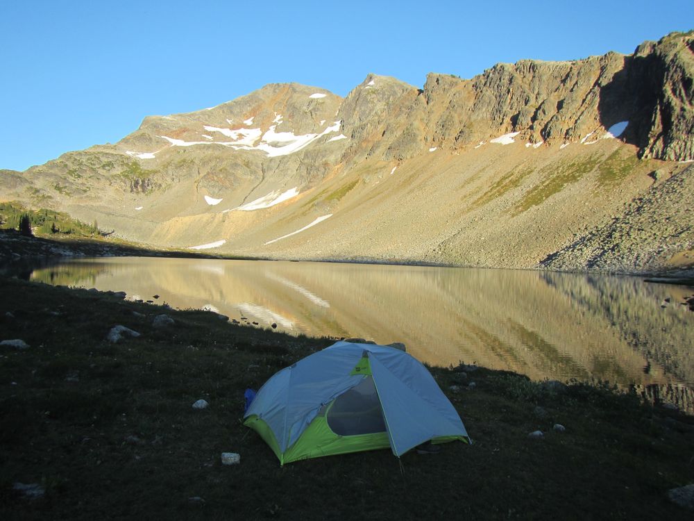
Amazing fall weather at Caltha Lake
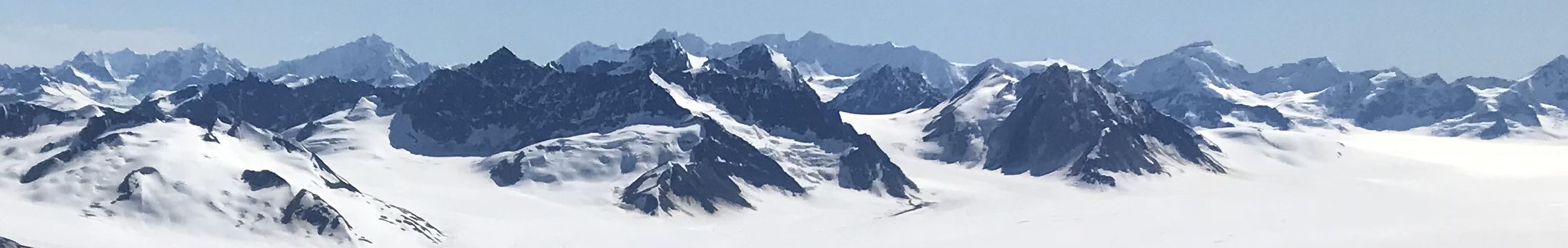
The views from Arrowhead Lake are fantastic and this is an ideal place to camp, since it’s a great swimming lake. We pressed on up past Heart Lake to the pass beside Tabletop Mountain, above Iceberg Lake. From the pass, the trail is a rough route following cairns and picking your way across a large boulder field. The views of Caltha Peak, Caltha Lake, and Tundra Peak were stunning – really amazing visibility. This is a great hike, but takes time. Eventually we dropped down towards the col on the west side of Caltha Peak, expecting an easy descent to Caltha Lake. Unfortunately, the trail passes through several really rough boulder fields on the south side of Caltha Peak – this is hard work and a better route would be to cut down lower much earlier.
Caltha Lake is a stunning place to camp and we had the whole area to ourselves – it was a glorious evening and unbelievably warm for Labour Day weekend. The Lake is freezing cold, and not the best for swimming.
Day 3 – Caltha Lake to Stein Divide and back to Arrowhead Lake (10.7 km, 655 m elevation gain)
In the night the wind seemed to pick up strength and we woke up to the smell of smoke and haze from the wildfires. Quite an amazing change in conditions. Before breaking camp we walked up to the Stein Divide – the col overlooking Tundra Lake. The view was not quite as amazing as we would have hoped the evening before, given the haze. The trail from here around Tundra Lake to the campsite also looks quite rough with lots of boulder fields to navigate. We dropped back down to Caltha Lake and returned all the way to Arrowhead Lake. From Caltha Lake, we picked a lower route to the col to miss most of the boulder fields, with the added advantage of some fantastic blueberry patches. At Arrowhead Lake we enjoyed an afternoon swim (freezing cold) and a great sunset (partly thanks to the wildfire haze).
Day 4 – Arrowhead Lake to Trailhead (17.5 km, 771 m elevation gain)
Our final day was the long march down from Arrowhead, via Lizzie Cabin, Lizzie Lake, and the old logging road. We were pretty fed up with the logging road by the time we finished. We took a slightly different (and better) route up to the active logging road. Unfortunately this meant we emerged about 1 km further up the active logging road and had to walk down to the car. It’s worth making sure to take the route we followed on the way out – neither trailhead is well marked, but the upper one is better.
Check out our Google Photos album.
Check out the GPS tracks and KML file:
GPX: Day 1, day 2, day 3, day 4
KMZ: all four days
Follow me!